



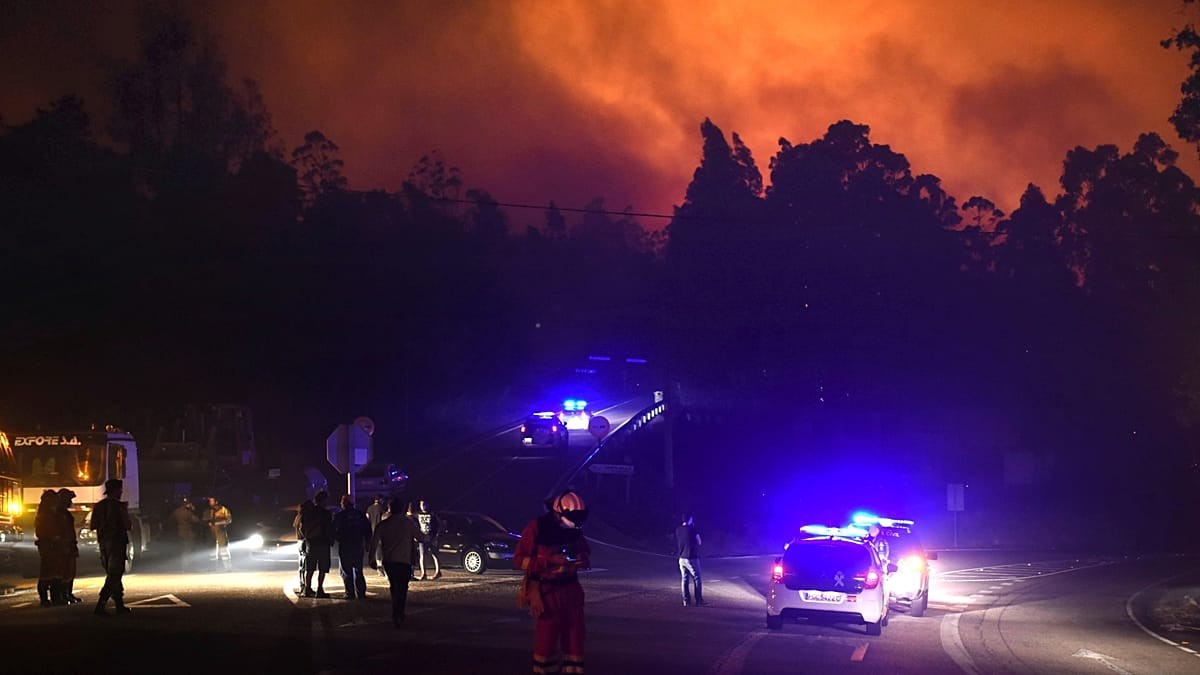
The numbers are hard to ignore. In 2025, Galicia lost more than 118,024 hectares of land to wildfire. That is an area bigger than Berlin. The region suffered its most destructive summer in decades. One single fire, the Larouco blaze in Ourense, became the largest recorded in Galician history.
These aren’t just blazes anymore. They are megafires.
The region has always been a tinderbox. Dense forestry. An aging rural population. Land abandoned to nature. It sat alongside Portugal and Greece as one of Europe’s most fire-prone zones. But standing still wasn’t an option. The regional government is now betting on artificial intelligence and satellite tech to change the odds.
They are launching the largest fire prevention plan in the region’s history. The price tag? €213 million.
How AI detects wildfires faster than human eyes
The goal is simple: shrink the window between ignition and detection. If you catch a fire in its first few minutes, you can contain it. If you wait until it burns through the night or hides in a remote valley, it spreads across thousands of hectares. Hours turn into disasters. The plan aims to cut that gap to mere minutes.
At the heart of this shift is Xeocode.
This is Galicia’s internal fire management platform. It went live ahead of the high-risk season on July 1. But it’s not just a dashboard. It is powered by convolutional neural networks. These are AI models built specifically to recognize patterns in images. They scan feeds from 241 surveillance cameras stationed in high-risk parishes.
What do these algorithms look for?
They hunt for the visual signatures of fire. A rising column of smoke. A distinct heat signature. A specific shift in color and movement across the landscape. It’s about pattern recognition at scale.
Two years of pilot testing showed the system can spot a fire from over 15 kilometers away. In favorable weather? That jumps to 25 kilometers. When a match is flagged, the system sends an automatic alert. A human technician then verifies it. Only then are crews deployed.
“We need to adapt to the new types of fires of enormous intensity seen in recent summers.”
Alfonso Rueda, Galicia’s regional president.
Why satellite constellations matter in Europe’s fire war
Galicia isn’t the only place turning to the sky. 2025 was Europe’s worst wildfire season on record. Over 1,079,924 hectares burned across 25 EU member states. The climate crisis is rewriting the map.
Greece has gone further than anyone. It is the first country to integrate a dedicated satellite constellations into its national firefighting system. Four nanosatellites—smaller than a piece of carry-on luggage—are now orbiting overhead. Built by the German firm OroraTech, they scan the country twice a day.
Their thermal sensors can flag blazes as small as four meters across.
The data is processed by AI before it ever reaches human eyes. Location. Size. Intensity. This information goes straight to national commanders. It helps them prioritize resources when multiple fires ignite simultaneously. The models are also trained to ignore false alarms. Sun-warmed rocks. Solar panels. Overheated factory roofs. None of these trigger an emergency response.
Where is Europe investing in fire prevention?
Portugal has seen the largest cumulative burnt area of any European nation over the past two decades. It has also begun integrating satellite detection into its response framework.
The trend is clear. Fire-prone states across southern Europe are adopting the same stack: ground cameras, orbital satellites, and machine learning. Galicia’s €213 million investment is a direct response to this shifting landscape. They aren’t trying to be unique. They are trying to be effective.
The Larouco fire changed everything for Galicia. It forced a rethinking of what “prevention” means. You can’t just put out fires anymore. You have to see them before they see you.
The technology exists. The satellites are in orbit. The neural networks are trained. The real question is whether speed is enough to outrun a changing climate.
One rhetorical question hangs in the smoky air of every summer briefing: If we can see a fire from 25 kilometers away, why are we still reacting?
The tools are here. The investment is made. The season begins on July 1. The rest is up to the spark.